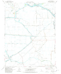
1978 Map of Holt
USGS Topo · Published 1978About this map
The San Joaquin River and the Stockton Deep Water Channel define the low-lying agricultural landscape of the San Joaquin Delta in this 1978 survey. This region is a complex network of reclaimed tracts and islands, including the Rindge Tract, Lower Jones Tract, and Roberts Island. Transportation and infrastructure are vital to these islands, evidenced by the Atchison Topeka and Santa Fe railroad cutting through the center and the McDonald Island Fy providing a river crossing. Small communities like Holt and Union Point serve as local hubs, while educational needs are met by the Holt Union Sch and Kingston School. The presence of the Mokelumne Aqueduct and numerous pumping stations underscores the intensive water management required to maintain these fertile tracts. Industrial activity is noted by a Gas Field and the U S Naval Reservation Rough and Ready on the eastern edge.
Find a feature on this map
58 named features on this map. Tap any name to fly to it.
Don’t see what you’re looking for? This feature index may not catch every label — zoom into the map to look around manually.
Map Details
Editions of this 1978 Holt Map
3 editions found
Other maps of this area

1894 · Lodi
USGS Topo · 1:125,000

1910 · Castle
USGS Topo · 1:31,680

1910 · Bouldin
USGS Topo · 1:31,680

1910 · Headreach
USGS Topo · 1:31,680

1913 · Woodward Island
USGS Topo · 1:31,680

1913 · Stockton
USGS Topo · 1:31,680

1913 · Holt
USGS Topo · 1:31,680

1914 · Bethany
USGS Topo · 1:31,680

1914 · Union Island
USGS Topo · 1:31,680

1915 · Lathrop
USGS Topo · 1:31,680