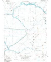
1978 Map of Holt
USGS Topo · Published 1991About this map
The low-lying reclaimed lands of the Sacramento-San Joaquin River Delta define this landscape, where complex networks of sloughs and cuts partition the territory into distinct tracts and islands. McDonald Island, Rindge Tract, and Lower Jones Tract are surrounded by water bodies like Whiskey Slough and the Stockton Deep Water Channel. The settlement at Holt serves as a local hub near the McKelumne Aqueduct, while smaller outposts like Union Point and Victoria Island are connected by a system of levees and rural roads such as Sea Level Road.
Find a feature on this map
61 named features on this map. Tap any name to fly to it.
Don’t see what you’re looking for? This feature index may not catch every label — zoom into the map to look around manually.
Map Details
Editions of this 1978 Holt Map
3 editions found
Other maps of this area

1894 · Lodi
USGS Topo · 1:125,000

1910 · Castle
USGS Topo · 1:31,680

1910 · Bouldin
USGS Topo · 1:31,680

1910 · Headreach
USGS Topo · 1:31,680

1913 · Woodward Island
USGS Topo · 1:31,680

1913 · Stockton
USGS Topo · 1:31,680

1913 · Holt
USGS Topo · 1:31,680

1914 · Bethany
USGS Topo · 1:31,680

1914 · Union Island
USGS Topo · 1:31,680

1915 · Lathrop
USGS Topo · 1:31,680