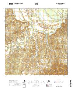
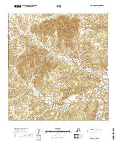
2017 Map of Holy Cross A-3 NE
USGS Topo · Published 2017About this map
Koserefski River dominates this northern wilderness landscape, winding through a complex network of wetlands and shifting channels. The terrain is characterized by the low-lying drainage patterns of the Deer Hunting Slough, illustrating the dynamic hydrological environment typical of the Yukon-Koyukuk region. This 2017 study by the U.S. Geological Survey captures the natural transition of water through the Interior, where river bends and sloughs continually reshape the floodplains. The map provides precise topographic detail for the townships of t25n r59w and t25n r58w, serving as a record of the remote Alaskan backcountry before further environmental or geomorphic shifts occur.
Find a feature on this map
6 named features on this map. Tap any name to fly to it.
Don’t see what you’re looking for? This feature index may not catch every label — zoom into the map to look around manually.
Map Details
Editions of this 2017 Holy Cross A-3 NE Map
This is the sole edition of this map. No revisions or reprints were ever made.
Other maps of this area

1951 · Holy Cross
USGS Topo · 1:250,000

1952 · Holy Cross B-2
USGS Topo · 1:63,360

1952 · Holy Cross A-2
USGS Topo · 1:63,360

1952 · Holy Cross B-3
USGS Topo · 1:63,360

1952 · Holy Cross A-3
USGS Topo · 1:63,360

1952 · Holy Cross
USGS Topo · 1:250,000
2017 · Holy Cross B-3 SE
USGS Topo · 1:25,000
2017 · Holy Cross A-3 SW
USGS Topo · 1:25,000
2017 · Holy Cross B-3 SW
USGS Topo · 1:25,000
2017 · Holy Cross A-3 NW
USGS Topo · 1:25,000