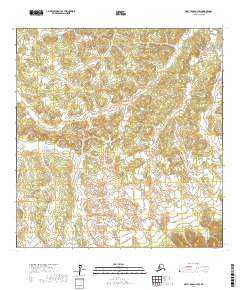
2017 Map of Holy Cross A-3 SW
USGS Topo · Published 2017About this map
Mountain Creek winds through the interior of the Yukon-Koyukuk region, defining the primary drainage pattern across this sub-arctic terrain. The landscape is characterized by a series of low, recurring hills and small depressions, typical of the permafrost-influenced topography found in the western Alaska interior. Surveyed during the 2010s, this document details the land divisions across several townships, including t23n r61w, t24n r60w, and t22n r61w. The absence of roads or permanent settlements emphasizes the undeveloped character of the wilderness surrounding the drainage basin of Mountain Creek, where the land remains largely defined by its natural watercourses and the Public Land Survey System grid.
Find a feature on this map
7 named features on this map. Tap any name to fly to it.
Don’t see what you’re looking for? This feature index may not catch every label — zoom into the map to look around manually.
Map Details
Editions of this 2017 Holy Cross A-3 SW Map
This is the sole edition of this map. No revisions or reprints were ever made.
Other maps of this area

1947 · Russian Mission
USGS Topo · 1:250,000

1950 · Russian Mission
USGS Topo · 1:250,000

1951 · Holy Cross
USGS Topo · 1:250,000

1952 · Holy Cross A-4
USGS Topo · 1:63,360

1952 · Holy Cross A-3
USGS Topo · 1:63,360

1952 · Holy Cross
USGS Topo · 1:250,000

1952 · Russian Mission D-4
USGS Topo · 1:63,360
1952 · Russian Mission D-5
USGS Topo · 1:63,360

1980 · Russian Mission
USGS Topo · 1:250,000
2017 · Russian Mission D-4 NW
USGS Topo · 1:25,000