
2019 Map of Holy Cross B-1 NE
USGS Topo · Published 2019About this map
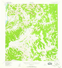
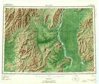
A complex network of drainage and elevation defines this uninhabited interior region of Alaska, documented by the U.S. Geological Survey in 2019. The landscape is characterized by its high-density contour intervals, revealing a series of unnamed ridges and valleys that crisscross the Public Land Survey System boundaries, including T27n R53w and T28n R53w. Because no roads, settlements, or named structures appear on the map, the survey focuses exclusively on the physical geography and the administrative divisions of the T26n R53w area. This sheet serves as a primary record of the terrain as it existed before any modern infrastructure or named landmarks were established in this part of the Yukon-Koyukuk Census Area.
Find a feature on this map
9 named features on this map. Tap any name to fly to it.
Don’t see what you’re looking for? This feature index may not catch every label — zoom into the map to look around manually.
Map Details
Editions of this 2019 Holy Cross B-1 NE Map
This is the sole edition of this map. No revisions or reprints were ever made.
Other maps of this area
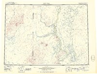
1951 · Holy Cross
USGS Topo · 1:250,000
1951 · Iditarod
USGS Topo · 1:250,000
1952 · Holy Cross C-1
USGS Topo · 1:63,360
1952 · Holy Cross B-1
USGS Topo · 1:63,360
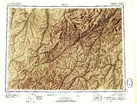
1952 · Holy Cross
USGS Topo · 1:250,000

1954 · Iditarod C-6
USGS Topo · 1:63,360
1954 · Iditarod B-6
USGS Topo · 1:63,360
1956 · Iditarod
USGS Topo · 1:250,000

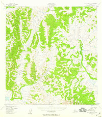
2019 · Holy Cross C-1 SE
USGS Topo · 1:25,000

2019 · Iditarod B-6 NW
USGS Topo · 1:25,000