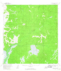
1954 Map of Iditarod B-6
USGS Topo · Published 1965About this map
The Big Yetna River and Little Yetna River carve through a landscape defined by expansive wetlands and watercourses in this 1950s survey. This interior Alaskan terrain is primarily traversed by a Winter Trail, a vital transport corridor that provided seasonal access across frozen ground and marshy lowlands. The presence of a isolated Cabin along the Reindeer River underscores the sparse human imprint on the region during the mid-20th century. This map represents an era of surveying before extensive modernization, documenting the natural drainage patterns and the primitive trail network used by trappers and early explorers of the Yukon-Koyukuk region.
Find a feature on this map
5 named features on this map. Tap any name to fly to it.
Don’t see what you’re looking for? This feature index may not catch every label — zoom into the map to look around manually.
Map Details
Editions of this 1954 Iditarod B-6 Map
3 editions found
Other maps of this area

1951 · Holy Cross
USGS Topo · 1:250,000

1951 · Iditarod
USGS Topo · 1:250,000

1952 · Holy Cross C-1
USGS Topo · 1:63,360

1952 · Holy Cross A-1
USGS Topo · 1:63,360

1952 · Holy Cross B-1
USGS Topo · 1:63,360

1952 · Holy Cross
USGS Topo · 1:250,000

1954 · Iditarod A-6
USGS Topo · 1:63,360

1954 · Iditarod A-5
USGS Topo · 1:63,360

1954 · Iditarod B-5
USGS Topo · 1:63,360

1954 · Iditarod C-5
USGS Topo · 1:63,360