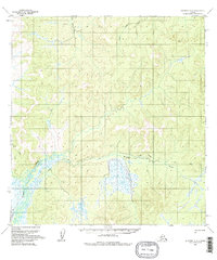
1954 Map of Iditarod B-6
USGS Topo · Published 1983About this map
The Big Yetna River and Little Yetna River converge in this remote interior landscape, creating a complex drainage system that defines the northern geography. Photogrammetric methods from 1953 aerial photography reveal a wilderness where human presence is marked by ephemeral traces rather than permanent infrastructure. Isolated Cabins and a singular Cabin are the only structures noted, likely serving as seasonal shelter for hunters or trappers operating along the riverbanks. Connectivity across the marshy lowlands depends on the seasonal Winter Trail, which provides a navigable route over frozen terrain that would be impassable in warmer months. The prominent elevation of Reindeer 1364 stands as a landmark above the meandering Reindeer River, which snakes through the southern portion of the quadrangle. This 1954 field-annotated survey captures the era before significant modern development, showing the original Trail networks that preceded mechanized transport in the region.
Find a feature on this map
8 named features on this map. Tap any name to fly to it.
Don’t see what you’re looking for? This feature index may not catch every label — zoom into the map to look around manually.
Map Details
Editions of this 1954 Iditarod B-6 Map
3 editions found
Other maps of this area

1951 · Holy Cross
USGS Topo · 1:250,000

1951 · Iditarod
USGS Topo · 1:250,000

1952 · Holy Cross C-1
USGS Topo · 1:63,360

1952 · Holy Cross A-1
USGS Topo · 1:63,360

1952 · Holy Cross B-1
USGS Topo · 1:63,360

1952 · Holy Cross
USGS Topo · 1:250,000

1954 · Iditarod A-6
USGS Topo · 1:63,360

1954 · Iditarod A-5
USGS Topo · 1:63,360

1954 · Iditarod B-5
USGS Topo · 1:63,360

1954 · Iditarod C-5
USGS Topo · 1:63,360