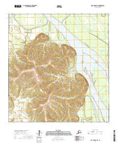
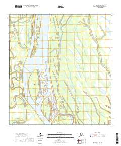
2017 Map of Holy Cross B-3 NE
USGS Topo · Published 2017About this map
The Yukon River dominates the eastern half of this landscape, carving a wide channel that separates the riverbanks from a series of alluvial features including Turtle Island, Joly Island, and Carlo Island. On the western shore, the terrain rises sharply into the Long Mountains, where the relief is marked by significant elevation changes contrasted against the flat, braided waterways of the north. The settlement of Paradise sits along the river's edge, positioned near the mouth of Paradise Creek. This area illustrates the classic interior Alaskan riverine environment, where the main river channel interacts with side passages like Bonasila Slough and prominent landmarks such as Cement Hill. The map detail shows the intersection of the river's path with the foot of the mountain range, highlighting a transition between the marshy lowland sloughs and the more stable upland geography.
Find a feature on this map
15 named features on this map. Tap any name to fly to it.
Don’t see what you’re looking for? This feature index may not catch every label — zoom into the map to look around manually.
Map Details
Editions of this 2017 Holy Cross B-3 NE Map
This is the sole edition of this map. No revisions or reprints were ever made.
Other maps of this area

1951 · Holy Cross
USGS Topo · 1:250,000

1952 · Holy Cross B-2
USGS Topo · 1:63,360

1952 · Holy Cross C-2
USGS Topo · 1:63,360

1952 · Holy Cross B-3
USGS Topo · 1:63,360

1952 · Holy Cross C-3
USGS Topo · 1:63,360

1952 · Holy Cross
USGS Topo · 1:250,000
2017 · Holy Cross B-3 SE
USGS Topo · 1:25,000
2017 · Holy Cross C-3 SW
USGS Topo · 1:25,000
2017 · Holy Cross B-3 SW
USGS Topo · 1:25,000
2017 · Holy Cross C-3 SE
USGS Topo · 1:25,000