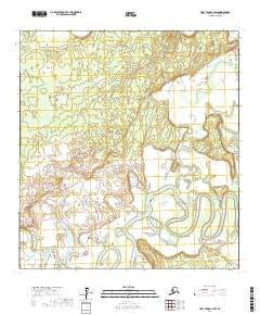
2017 Map of Holy Cross C-3 SW
USGS Topo · Published 2017About this map
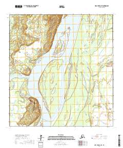
Bonasila River defines the landscape of this portion of the Yukon-Koyukuk Census Area, winding through a complex network of wetlands and oxbow lakes. The river's serpentine path through the southern half of the quadrangle suggests a dynamic alluvial environment where the watercourse frequently shifts over time. This interior Alaskan terrain is primarily documented through its township and range lines, including t29n r60w, t29n r59w, and t28n r60w, which provide the legal framework for this expansive wilderness. The absence of road infrastructure or permanent settlements underscores the isolation of this river valley, making the waterway the primary point of reference for anyone navigating or studying the hydrologic patterns of the region.
Find a feature on this map
6 named features on this map. Tap any name to fly to it.
Don’t see what you’re looking for? This feature index may not catch every label — zoom into the map to look around manually.
Map Details
Editions of this 2017 Holy Cross C-3 SW Map
This is the sole edition of this map. No revisions or reprints were ever made.
Other maps of this area

1951 · Holy Cross
USGS Topo · 1:250,000

1952 · Holy Cross B-3
USGS Topo · 1:63,360

1952 · Holy Cross C-3
USGS Topo · 1:63,360

1952 · Holy Cross C-4
USGS Topo · 1:63,360

1952 · Holy Cross B-4
USGS Topo · 1:63,360

1952 · Holy Cross
USGS Topo · 1:250,000
2017 · Holy Cross B-3 NE
USGS Topo · 1:25,000
2017 · Holy Cross C-4 SE
USGS Topo · 1:25,000
2017 · Holy Cross C-4 NE
USGS Topo · 1:25,000
2017 · Holy Cross C-3 NE
USGS Topo · 1:25,000