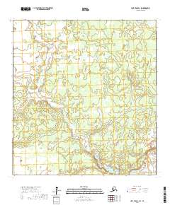
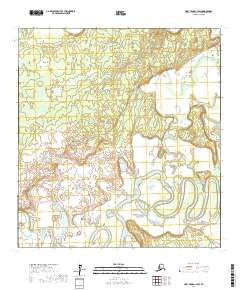
2017 Map of Holy Cross C-4 SE
USGS Topo · Published 2017About this map
Bonasila River meanders across the southeastern corner of this landscape in the Yukon-Koyukuk Census Area. This remote interior terrain is defined by its complex hydrography and shifting drainage patterns, as seen in the intricate contour lines and wetlands managed by the U.S. Geological Survey. The map provides a precise layout of the Public Land Survey System divisions, including sections of t28n r61w and t29n r61w, which are essential for identifying specific land allotments and wilderness boundaries in this part of Alaska.
Find a feature on this map
5 named features on this map. Tap any name to fly to it.
Don’t see what you’re looking for? This feature index may not catch every label — zoom into the map to look around manually.
Map Details
Editions of this 2017 Holy Cross C-4 SE Map
This is the sole edition of this map. No revisions or reprints were ever made.
Other maps of this area

1951 · Holy Cross
USGS Topo · 1:250,000

1952 · Holy Cross B-3
USGS Topo · 1:63,360

1952 · Holy Cross C-3
USGS Topo · 1:63,360

1952 · Holy Cross C-4
USGS Topo · 1:63,360

1952 · Holy Cross B-4
USGS Topo · 1:63,360

1952 · Holy Cross
USGS Topo · 1:250,000
2017 · Holy Cross C-4 SW
USGS Topo · 1:25,000
2017 · Holy Cross C-4 NE
USGS Topo · 1:25,000
2017 · Holy Cross B-4 NW
USGS Topo · 1:25,000
2017 · Holy Cross C-3 SW
USGS Topo · 1:25,000