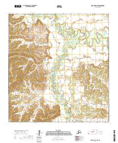
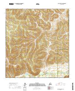
2017 Map of Holy Cross B-4 NW
USGS Topo · Published 2017About this map
Bonasila River and its intricate meander loops define this unpopulated stretch of the Yukon-Koyukuk Census Area in west-central Alaska. The terrain transition is sharp, as the flat, water-logged lowlands of the river valley meet the rising slopes of unnamed ridges to the west. These hills, documented within Township 27 North, Range 63 West, reach elevations that overlook the drainage basins of the Stuyahok River and the Hawk River in the north. This 2017 survey illustrates a landscape of complex hydrology where oxbow lakes and abandoned channels reflect the shifting nature of the local waterways over time. Without roads or settlements, the map focuses on the natural topography and the legal boundaries of the Public Land Survey System, providing a baseline for environmental study or navigation in the Alaskan interior.
Find a feature on this map
9 named features on this map. Tap any name to fly to it.
Don’t see what you’re looking for? This feature index may not catch every label — zoom into the map to look around manually.
Map Details
Editions of this 2017 Holy Cross B-4 NW Map
This is the sole edition of this map. No revisions or reprints were ever made.
Other maps of this area

1951 · Holy Cross
USGS Topo · 1:250,000

1952 · Holy Cross C-5
USGS Topo · 1:63,360

1952 · Holy Cross B-5
USGS Topo · 1:63,360

1952 · Holy Cross C-4
USGS Topo · 1:63,360

1952 · Holy Cross B-4
USGS Topo · 1:63,360

1952 · Holy Cross
USGS Topo · 1:250,000
2017 · Holy Cross B-4 SW
USGS Topo · 1:25,000
2017 · Holy Cross B-4 SE
USGS Topo · 1:25,000
2017 · Holy Cross B-5 SE
USGS Topo · 1:25,000
2017 · Holy Cross C-5 SE
USGS Topo · 1:25,000