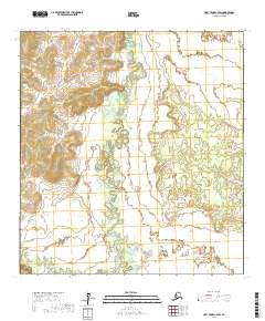
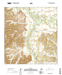
2017 Map of Holy Cross C-4 SW
USGS Topo · Published 2017About this map
The Bonasila River snakes through this Alaskan landscape, defining the interior drainage of the Yukon-Koyukuk region. This 2017 study illustrates the intricate, meandering path of the watercourse as it weaves across the lowlands, creating a dense network of oxbow lakes and wetlands. In the southwestern corner, the Hawk River enters the frame, marking a point of hydrological convergence. The map provides a precise look at the township and range boundaries, including t29n r62w and t28n r63w, which delineate the vast, uninhabited terrain. For those interested in the remote geography of the Alaskan interior, the map reveals the subtle topographic variations and the shifting nature of these wilderness rivers.
Find a feature on this map
6 named features on this map. Tap any name to fly to it.
Don’t see what you’re looking for? This feature index may not catch every label — zoom into the map to look around manually.
Map Details
Editions of this 2017 Holy Cross C-4 SW Map
This is the sole edition of this map. No revisions or reprints were ever made.
Other maps of this area

1951 · Holy Cross
USGS Topo · 1:250,000

1952 · Holy Cross C-5
USGS Topo · 1:63,360

1952 · Holy Cross B-5
USGS Topo · 1:63,360

1952 · Holy Cross C-4
USGS Topo · 1:63,360

1952 · Holy Cross B-4
USGS Topo · 1:63,360

1952 · Holy Cross
USGS Topo · 1:250,000
2017 · Holy Cross C-5 SE
USGS Topo · 1:25,000
2017 · Holy Cross C-4 SE
USGS Topo · 1:25,000
2017 · Holy Cross C-4 NE
USGS Topo · 1:25,000
2017 · Holy Cross B-4 NW
USGS Topo · 1:25,000