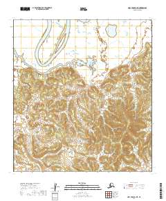
2019 Map of Holy Cross D-1 NE
USGS Topo · Published 2019About this map
The Innoko River winds through the northern reaches of this territory in the Yukon-Koyukuk Census Area, defining a landscape dominated by complex waterways and intricate wetlands. This 2019 survey illustrates the dramatic meanders of the river as it cuts through the flat lowlands before the terrain rises into the more defined ridges and hills to the south. The area is marked by a rigorous grid of the Public Land Survey System, including T34n R52w, T33n R52w, and T32n R52w, which provide essential reference points for land claims and wilderness navigation in this largely undeveloped portion of Alaska.
Find a feature on this map
11 named features on this map. Tap any name to fly to it.
Don’t see what you’re looking for? This feature index may not catch every label — zoom into the map to look around manually.
Map Details
Editions of this 2019 Holy Cross D-1 NE Map
This is the sole edition of this map. No revisions or reprints were ever made.
Other maps of this area

1951 · Ophir
USGS Topo · 1:250,000

1951 · Unalakleet
USGS Topo · 1:250,000

1951 · Holy Cross
USGS Topo · 1:250,000

1951 · Iditarod
USGS Topo · 1:250,000

1952 · Unalakleet A-1
USGS Topo · 1:63,360

1952 · Holy Cross D-1
USGS Topo · 1:63,360

1952 · Unalakleet
USGS Topo · 1:250,000

1952 · Holy Cross
USGS Topo · 1:250,000

1954 · Ophir A-6
USGS Topo · 1:63,360

1954 · Iditarod D-6
USGS Topo · 1:63,360