
1952 Map of Unalakleet A-1
USGS Topo · Published 1959About this map
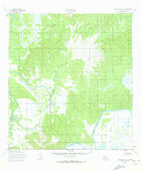
Innoko River winds through this interior Alaskan landscape as it appeared in the early 1950s. The topography here is characterized by complex drainage patterns where the river and Sucker Creek cut through the hills. This 1952 survey, mapped by the Army Map Service using aerial photography from 1951, provides a detailed look at the watershed before modern development. The absence of named settlements, roads, or trails reflects the isolation of the Yukon-Koyukuk region during this period, leaving the natural hydrology of the river systems as the primary markers of the territory.
Find a feature on this map
2 named features on this map. Tap any name to fly to it.
Don’t see what you’re looking for? This feature index may not catch every label — zoom into the map to look around manually.
Map Details
Editions of this 1952 Unalakleet A-1 Map
3 editions found
Other maps of this area

1951 · Ophir
USGS Topo · 1:250,000

1951 · Unalakleet
USGS Topo · 1:250,000

1951 · Holy Cross
USGS Topo · 1:250,000

1951 · Iditarod
USGS Topo · 1:250,000

1952 · Unalakleet A-2
USGS Topo · 1:63,360

1952 · Holy Cross D-2
USGS Topo · 1:63,360

1952 · Holy Cross D-1
USGS Topo · 1:63,360

1952 · Unalakleet B-2
USGS Topo · 1:63,360

1952 · Unalakleet B-1
USGS Topo · 1:63,360

1952 · Unalakleet
USGS Topo · 1:250,000