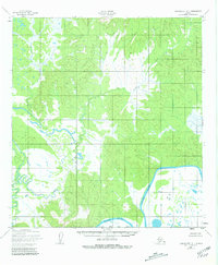
1952 Map of Unalakleet A-1
USGS Topo · Published 1981About this map
Innoko River meanders through this interior Alaska landscape, creating a complex network of wetlands and oxbow lakes that define the region's geography. The map reflects the area's state in the early 1950s, a period when the Innoko National Wildlife Refuge had not yet been established as it is today, though the entire quadrangle now falls within its protected bounds. The hydrology is dominated by the wandering path of Sucker Creek, which flows through terrain marked by the South Boundary Kateel River Meridian. This survey, based on 1951 aerial photography, documents the natural drainage patterns and the absence of established roads or trails during this era of northern exploration.
Find a feature on this map
5 named features on this map. Tap any name to fly to it.
Don’t see what you’re looking for? This feature index may not catch every label — zoom into the map to look around manually.
Map Details
Editions of this 1952 Unalakleet A-1 Map
3 editions found
Other maps of this area

1951 · Ophir
USGS Topo · 1:250,000

1951 · Unalakleet
USGS Topo · 1:250,000

1951 · Holy Cross
USGS Topo · 1:250,000

1951 · Iditarod
USGS Topo · 1:250,000

1952 · Unalakleet A-2
USGS Topo · 1:63,360

1952 · Unalakleet A-1
USGS Topo · 1:63,360

1952 · Holy Cross D-2
USGS Topo · 1:63,360

1952 · Holy Cross D-1
USGS Topo · 1:63,360

1952 · Unalakleet B-2
USGS Topo · 1:63,360

1952 · Unalakleet B-1
USGS Topo · 1:63,360