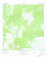
1952 Map of Unalakleet A-1
USGS Topo · Published 1973About this map
The Innoko River dominates the southeastern quadrant of this 1952 topographic study, winding through the lowlands of the Yukon-Koyukuk region. This map, based on 1951 aerial photography, captures a wilderness landscape defined by complex drainage patterns and marshy terrain, long before significant modern infrastructure reached this part of Alaska. Tributaries like Sucker Creek meander through the central and western portions of the quadrangle, illustrating the intricate hydrology of the area north of the South Boundary Kateel River Meridian. The absence of roads or trails during this era underscores the importance of natural waterways as primary corridors for movement through this remote subarctic environment.
Find a feature on this map
4 named features on this map. Tap any name to fly to it.
Don’t see what you’re looking for? This feature index may not catch every label — zoom into the map to look around manually.
Map Details
Editions of this 1952 Unalakleet A-1 Map
3 editions found
Other maps of this area

1951 · Ophir
USGS Topo · 1:250,000

1951 · Unalakleet
USGS Topo · 1:250,000

1951 · Holy Cross
USGS Topo · 1:250,000

1951 · Iditarod
USGS Topo · 1:250,000

1952 · Unalakleet A-2
USGS Topo · 1:63,360

1952 · Unalakleet A-1
USGS Topo · 1:63,360

1952 · Holy Cross D-2
USGS Topo · 1:63,360

1952 · Holy Cross D-1
USGS Topo · 1:63,360

1952 · Unalakleet B-2
USGS Topo · 1:63,360

1952 · Unalakleet B-1
USGS Topo · 1:63,360