
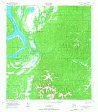
1952 Map of Unalakleet B-1
USGS Topo · Published 1959About this map
The Yukon River dominates the western edge of this sub-arctic landscape, its braided channels and shifting bars creating a complex aquatic environment marked by Blackburn Island. Surveyed in the early 1950s, the map reveals a remote interior where transportation relied on the seasonal Winter Trail and the river's winding tributaries. Small-scale human activity is evidenced by a cluster of Cabins situated along the riverbanks, likely serving as seasonal camps for trapping or fishing. To the east, the terrain rises sharply from the river lowlands into densely contoured hills drained by Papa Willie Creek, Shovel Creek, and Saint Joe Creek. The map documents a period before modern infrastructure reached this portion of the Alaskan interior, showing the land as it was navigated by those relying on established water routes and ephemeral trails.
Find a feature on this map
7 named features on this map. Tap any name to fly to it.
Don’t see what you’re looking for? This feature index may not catch every label — zoom into the map to look around manually.
Map Details
Editions of this 1952 Unalakleet B-1 Map
2 editions found
Other maps of this area

1951 · Ophir
USGS Topo · 1:250,000

1951 · Unalakleet
USGS Topo · 1:250,000

1952 · Unalakleet A-2
USGS Topo · 1:63,360

1952 · Unalakleet C-2
USGS Topo · 1:63,360

1952 · Unalakleet A-1
USGS Topo · 1:63,360

1952 · Unalakleet C-1
USGS Topo · 1:63,360

1952 · Unalakleet B-2
USGS Topo · 1:63,360

1952 · Unalakleet
USGS Topo · 1:250,000

1954 · Ophir A-6
USGS Topo · 1:63,360

1954 · Ophir C-6
USGS Topo · 1:63,360