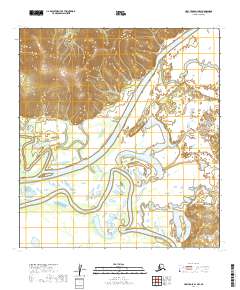
2019 Map of Holy Cross D-1 NW
USGS Topo · Published 2019About this map
The Innoko River dominates this interior Alaskan landscape, winding through a complex network of active and abandoned river channels. This 2019 survey captures the dynamic hydrology of the region, where the primary river course meanders significantly, leaving behind features like the Holikachuk Slough. The terrain is defined by low-lying wetlands and seasonal floodplains, typical of the Yukon-Koyukuk region, where water determines the movement and settlement patterns of the land. In the northern sections of the map, the topography rises into hills that overlook the river valley, providing a stark contrast to the saturated lowlands. The presence of these specific waterways indicates a remote, water-dependent environment where natural features serve as the primary landmarks and navigational routes.
Find a feature on this map
11 named features on this map. Tap any name to fly to it.
Don’t see what you’re looking for? This feature index may not catch every label — zoom into the map to look around manually.
Map Details
Editions of this 2019 Holy Cross D-1 NW Map
This is the sole edition of this map. No revisions or reprints were ever made.
Other maps of this area

1951 · Unalakleet
USGS Topo · 1:250,000

1951 · Holy Cross
USGS Topo · 1:250,000

1952 · Unalakleet A-2
USGS Topo · 1:63,360

1952 · Unalakleet A-1
USGS Topo · 1:63,360

1952 · Holy Cross D-2
USGS Topo · 1:63,360

1952 · Holy Cross D-1
USGS Topo · 1:63,360

1952 · Unalakleet
USGS Topo · 1:250,000

1952 · Holy Cross
USGS Topo · 1:250,000

1964 · Unalakleet
USGS Topo · 1:250,000
2017 · Unalakleet A-1 SW
USGS Topo · 1:25,000