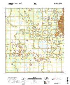
2019 Map of Holy Cross D-2 NE
USGS Topo · Published 2019About this map
Holikachuk stands as a primary point of interest along the banks of the Innoko River, positioned within a complex network of waterways that define the Yukon-Koyukuk interior. This 2019 survey documents the intricate drainage patterns where the river meets the Holikachuk Slough and the winding Shageluk Slough. The landscape is characterized by its high-density hydrology, showing the natural meandering of these channels through the floodplain.
Find a feature on this map
12 named features on this map. Tap any name to fly to it.
Don’t see what you’re looking for? This feature index may not catch every label — zoom into the map to look around manually.
Map Details
Editions of this 2019 Holy Cross D-2 NE Map
This is the sole edition of this map. No revisions or reprints were ever made.
Other maps of this area

1951 · Unalakleet
USGS Topo · 1:250,000

1951 · Holy Cross
USGS Topo · 1:250,000

1952 · Unalakleet A-2
USGS Topo · 1:63,360

1952 · Unalakleet A-1
USGS Topo · 1:63,360

1952 · Holy Cross D-2
USGS Topo · 1:63,360

1952 · Holy Cross D-1
USGS Topo · 1:63,360

1952 · Unalakleet
USGS Topo · 1:250,000

1952 · Holy Cross
USGS Topo · 1:250,000

1964 · Unalakleet
USGS Topo · 1:250,000
2016 · Unalakleet A-2 SW
USGS Topo · 1:25,000