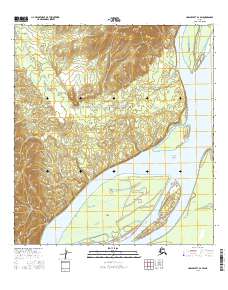
2016 Map of Unalakleet A-2 SW
USGS Topo · Published 2016About this map
The Nulato Hills rise sharply along the western edge of this interior landscape, overlooking the wide, braided course of the Yukon River. The river corridor dominates the eastern half of the sheet, where the water fragments into complex channels around substantial landforms like Flat Island, Fox Point Island, and Betty Island. These islands, coupled with the winding Shageluk Slough, illustrate a dynamic riparian environment where seasonal water levels and silt deposits constantly reshape the navigation of the interior.
Find a feature on this map
13 named features on this map. Tap any name to fly to it.
Don’t see what you’re looking for? This feature index may not catch every label — zoom into the map to look around manually.
Map Details
Editions of this 2016 Unalakleet A-2 SW Map
This is the sole edition of this map. No revisions or reprints were ever made.
Other maps of this area

1951 · Unalakleet
USGS Topo · 1:250,000

1951 · Holy Cross
USGS Topo · 1:250,000

1952 · Unalakleet A-2
USGS Topo · 1:63,360

1952 · Unalakleet A-3
USGS Topo · 1:63,360

1952 · Holy Cross D-2
USGS Topo · 1:63,360

1952 · Holy Cross D-3
USGS Topo · 1:63,360

1952 · Unalakleet
USGS Topo · 1:250,000

1952 · Holy Cross
USGS Topo · 1:250,000

1964 · Unalakleet
USGS Topo · 1:250,000
2015 · Unalakleet A-3 NE
USGS Topo · 1:25,000