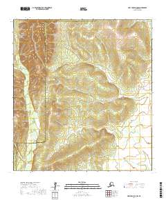
2017 Map of Holy Cross D-4 NW
USGS Topo · Published 2017About this map
The Nulato Hills dominate this portion of the Alaskan interior, representing a landscape of high-elevation ridgelines and drainage basins. This area is defined by its topographic transition across the boundary of the Kusilvak Census Area and the Yukon-Koyukuk Census Area, a division that marks the administrative partitioning of the wilderness. The drainage patterns of Beaver Cr and Short Cr weave through the lower elevations, illustrating the natural watershed that has historically dictated travel and seasonal movement through this territory. The absence of modern infrastructure or established settlements emphasizes the remote character of this region, where the terrain itself remains the primary historical record for those studying traditional land use or environmental history in the Alaskan bush.
Find a feature on this map
4 named features on this map. Tap any name to fly to it.
Don’t see what you’re looking for? This feature index may not catch every label — zoom into the map to look around manually.
Map Details
Editions of this 2017 Holy Cross D-4 NW Map
This is the sole edition of this map. No revisions or reprints were ever made.
Other maps of this area

1951 · Unalakleet
USGS Topo · 1:250,000

1951 · Holy Cross
USGS Topo · 1:250,000

1952 · Unalakleet A-4
USGS Topo · 1:63,360

1952 · Unalakleet A-5
USGS Topo · 1:63,360

1952 · Holy Cross D-5
USGS Topo · 1:63,360

1952 · Holy Cross D-4
USGS Topo · 1:63,360

1952 · Unalakleet
USGS Topo · 1:250,000

1952 · Holy Cross
USGS Topo · 1:250,000

1964 · Unalakleet
USGS Topo · 1:250,000
2016 · Unalakleet A-4 SE
USGS Topo · 1:25,000