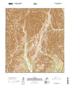
2017 Map of Holy Cross D-5 NE
USGS Topo · Published 2017About this map
Nulato Hills dominate this portion of the interior, presenting a high-relief landscape of ridges and drainage basins. The Bonasila River snakes through the southwest corner of the quadrangle, serving as the primary hydraulic feature in an area defined by its complex network of seasonal and perennial streams. To the northeast, the headwaters of Beaver Cr emerge from the steep slopes, while Willow Cr and Short Cr drain the central and southeastern elevations. This 2017 survey reflects a wilderness character primarily organized by topographical boundaries and township lines, including t33n r63w and t34n r62w, showing a region largely devoid of permanent human infrastructure or road networks. The map provides a clear record of the hydrography that dictates movement through this part of the Kusilvak Census Area.
Find a feature on this map
11 named features on this map. Tap any name to fly to it.
Don’t see what you’re looking for? This feature index may not catch every label — zoom into the map to look around manually.
Map Details
Editions of this 2017 Holy Cross D-5 NE Map
This is the sole edition of this map. No revisions or reprints were ever made.
Other maps of this area

1951 · Unalakleet
USGS Topo · 1:250,000

1951 · Holy Cross
USGS Topo · 1:250,000

1952 · Unalakleet A-4
USGS Topo · 1:63,360

1952 · Unalakleet A-5
USGS Topo · 1:63,360

1952 · Holy Cross D-5
USGS Topo · 1:63,360

1952 · Holy Cross D-4
USGS Topo · 1:63,360

1952 · Unalakleet
USGS Topo · 1:250,000

1952 · Holy Cross
USGS Topo · 1:250,000

1964 · Unalakleet
USGS Topo · 1:250,000
2016 · Unalakleet A-4 SW
USGS Topo · 1:25,000