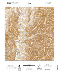
2017 Map of Holy Cross D-6 NE
USGS Topo · Published 2017About this map
Nulato Hills dominate the terrain of this remote portion of the Kusilvak Census Area, where the topography rises sharply from the river valley into a complex series of ridges and summits. The central geographic feature is the East Fork Andreafsky River, which carves a wide, meandering path through the western half of the landscape. This area of the Alaskan interior remains largely undeveloped, defined by its massive wetland systems and the intricate drainage patterns of the river's tributaries. The map provides a detailed view of the natural hydrology and elevation of this wilderness before modern infrastructure reached this section of the state, serving as a primary reference for the untouched landscape of the East Fork Andreafsky River basin.
Find a feature on this map
10 named features on this map. Tap any name to fly to it.
Don’t see what you’re looking for? This feature index may not catch every label — zoom into the map to look around manually.
Map Details
Editions of this 2017 Holy Cross D-6 NE Map
This is the sole edition of this map. No revisions or reprints were ever made.
Other maps of this area

1951 · Unalakleet
USGS Topo · 1:250,000

1951 · Holy Cross
USGS Topo · 1:250,000

1952 · Unalakleet A-5
USGS Topo · 1:63,360

1952 · Holy Cross D-5
USGS Topo · 1:63,360

1952 · Unalakleet A-6
USGS Topo · 1:63,360
1952 · Holy Cross D-6
USGS Topo · 1:63,360

1952 · Unalakleet
USGS Topo · 1:250,000

1952 · Holy Cross
USGS Topo · 1:250,000

1964 · Unalakleet
USGS Topo · 1:250,000
2017 · Holy Cross D-6 NW
USGS Topo · 1:25,000