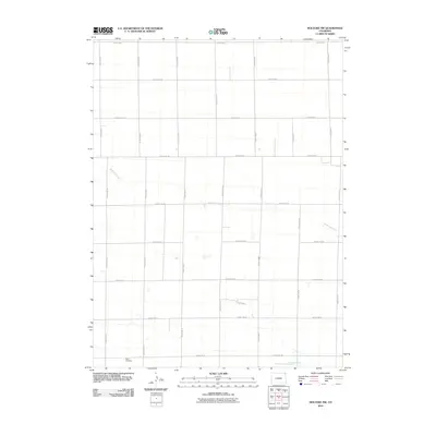
2010 Map of Holyoke NW
USGS Topo · Published 2010About this map
Paoli Cemetery sits at the southwestern edge of this High Plains landscape, serving as a primary landmark for local genealogical research in this part of Sedgwick County. The terrain is defined by a strictly organized section-line road network, including County Rd-2 and County Rd-17, which overlay the natural hydrology of the region. The intermittent flows of Wildhorse Creek and the North Fork Frenchman Creek cut through the geometric grid of agricultural parcels, showing how modern land management interacts with the subtle drainage patterns of the eastern Colorado plains. This survey provides a clear view of the rural infrastructure at the start of the 21st century, where the placement of cemeteries and the path of named creeks remain the central anchors for identifying historical family homesteads and local property lines.
Find a feature on this map
20 named features on this map. Tap any name to fly to it.
Don’t see what you’re looking for? This feature index may not catch every label — zoom into the map to look around manually.
Map Details
Editions of this 2010 Holyoke NW Map
This is the sole edition of this map. No revisions or reprints were ever made.
Other maps of this area

1952 · Julesburg SW
USGS Topo · 1:24,000

1952 · Julesburg SE
USGS Topo · 1:24,000

1952 · Marks Butte
USGS Topo · 1:24,000

1954 · Sterling
USGS Topo · 1:250,000

1958 · Sterling
USGS Topo · 1:250,000

1962 · Holyoke NE
USGS Topo · 1:24,000

1962 · Haxtun East
USGS Topo · 1:24,000

1962 · Holyoke NW
USGS Topo · 1:24,000

1971 · Paoli
USGS Topo · 1:24,000

1971 · Holyoke
USGS Topo · 1:24,000