
1949 Map of Holyoke
USGS Topo · Published 1949About this map
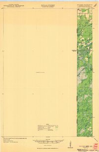
The Minnesota-Wisconsin borderlands appear here as a landscape defined by timber, water, and the reach of the rail line just after the war. The settlement of Foxboro and the nearby Nelson Sch anchor the northern portion of the survey, where the Minneapolis St Paul and Sault Ste Marie RR cuts across the state line. Much of the western interior remains a sprawling Unsurveyed Area, contrasting with the intricate network of water in the east, including Black Lake and the winding Black River. These hydrological features, along with Balsam Creek and East Br Hay Creek, illustrate the low-lying, marshy terrain of the region. The map preserves the transition between Carlton and Pine Counties in Minnesota and Pine and Douglas Counties in Wisconsin.
Find a feature on this map
11 named features on this map. Tap any name to fly to it.
Don’t see what you’re looking for? This feature index may not catch every label — zoom into the map to look around manually.
Map Details
Editions of this 1949 Holyoke Map
2 editions found
Other maps of this area

1915 · Superior
USGS Topo · 1:48,000

1917 · Superior
USGS Topo · 1:62,500

1949 · Danbury
USGS Topo · 1:48,000

1949 · Webb Lake
USGS Topo · 1:48,000

1949 · Patzau
USGS Topo · 1:48,000

1953 · Duluth
USGS Topo · 1:250,000

1954 · Borea
USGS Topo · 1:24,000

1954 · Foxboro
USGS Topo · 1:24,000

1954 · Wrenshall
USGS Topo · 1:24,000

1954 · Frogner
USGS Topo · 1:24,000