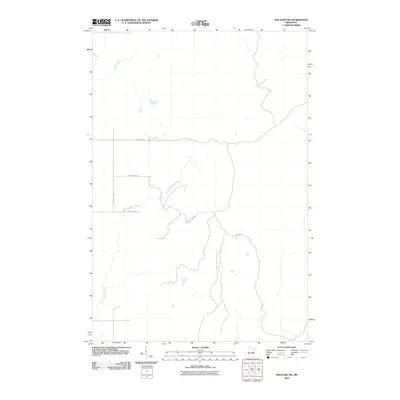
2010 Map of Holyoke SW
USGS Topo · Published 2010About this map
Willow River and the Lower Tamarack River define this quiet stretch of the Minnesota backcountry within Nickerson Township during the early 21st century. The landscape is marked by the winding courses of these waterways as they carve through the terrain, flanked by a sparse network of forest and boundary roads. A few distinct routes provide access to the area, including Town Line Rd and Park Forest Rd, which suggest a region managed for timber or recreation rather than dense residential development. Small access ways like Trails End Rd and Park Hills Rd reach into the interior, reflecting the rural character and the enduring importance of river drainage patterns in Pine County.
Find a feature on this map
7 named features on this map. Tap any name to fly to it.
Don’t see what you’re looking for? This feature index may not catch every label — zoom into the map to look around manually.
Map Details
Editions of this 2010 Holyoke SW Map
This is the sole edition of this map. No revisions or reprints were ever made.
Other maps of this area

1949 · Danbury
USGS Topo · 1:48,000

1949 · Holyoke
USGS Topo · 1:48,000

1953 · Duluth
USGS Topo · 1:250,000

1954 · Foxboro
USGS Topo · 1:24,000

1958 · Duluth
USGS Topo · 1:250,000

1962 · Holyoke
USGS Topo · 1:62,500

1962 · Bruno
USGS Topo · 1:62,500

1962 · Cloverdale
USGS Topo · 1:62,500

1962 · Danbury
USGS Topo · 1:62,500

1980 · Sandstone
USGS Topo · 1:100,000