
1916 Map of Home
USGS Topo · Published 1954About this map
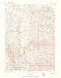
Manhattan and the high mountain ranching country of northern Colorado are documented here just before the era of modern highway development. This 1916 survey, conducted by Basil Duke and C. A. Ecklund, reveals a landscape defined by isolated settlements and a complex hydrological network designed to move water across the divide. The engineering feat of the Laramie-Poudre Tunnel is a central feature, connecting the drainage systems of the Laramie River and the North Fork Poudre River.
Find a feature on this map
93 named features on this map. Tap any name to fly to it.
Don’t see what you’re looking for? This feature index may not catch every label — zoom into the map to look around manually.
Map Details
Editions of this 1916 Home Map
2 editions found
Other maps of this area

1895 · Laramie
USGS Topo · 1:125,000

1902 · Laramie
USGS Topo · 1:125,000

1905 · Sherman
USGS Topo · 1:125,000

1905 · Laramie
USGS Topo · 1:125,000

1905 · Mount Olympus
USGS Topo · 1:62,500

1906 · Medicine Bow
USGS Topo · 1:125,000

1906 · Laramie
USGS Topo · 1:125,000

1907 · Mount Olympus
USGS Topo · 1:62,500

1907 · Livermore
USGS Topo · 1:125,000

1908 · Laramie
USGS Topo · 1:125,000