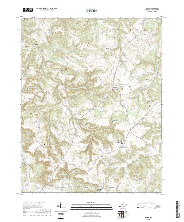
2022 Map of Homer
USGS Topo · Published 2022About this map
Chandlers Chapel and the surrounding rural communities of Logan County define this agricultural landscape. The map reveals a dense network of family and community burial grounds, including the Oak Grove Baptist Church Cem, Plainview Mennonite Cem, and the Samuel Price Cem, which offer significant data points for genealogists tracing local lineages. The terrain is deeply etched by the winding course of the Mud River and its tributaries like Motts Lick Creek, with the presence of Briggs Lake and the Lone Pine Aerodrome punctuating the southern reaches.
Find a feature on this map
87 named features on this map. Tap any name to fly to it.
Don’t see what you’re looking for? This feature index may not catch every label — zoom into the map to look around manually.
Map Details
Editions of this 2022 Homer Map
This is the sole edition of this map. No revisions or reprints were ever made.
Other maps of this area

1911 · Dunmor
USGS Topo · 1:48,000

1914 · Little Muddy
USGS Topo · 1:62,500

1914 · Dunmor
USGS Topo · 1:62,500

1951 · Auburn
USGS Topo · 1:24,000

1951 · Lewisburg
USGS Topo · 1:24,000

1951 · South Union
USGS Topo · 1:24,000

1951 · Homer
USGS Topo · 1:24,000

1952 · Russellville
USGS Topo · 1:24,000

1952 · Dennis
USGS Topo · 1:24,000

1953 · Dunmor
USGS Topo · 1:24,000