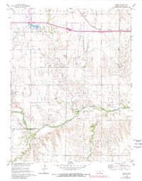
1961 Map of Homer
USGS Topo · Published 1980About this map
The Smoky Hill River winds across this Central Kansas landscape, defining a terrain shaped by both water and mineral extraction. The 1961 topography reveals an economy centered on the Grant Oil Field and Fairfield Oil Field, where numerous extraction points dot the landscape between the river and the Union Pacific rail line. Near the settlement of Homer, the Russell Municipal Airport serves the region's transportation needs.
Find a feature on this map
20 named features on this map. Tap any name to fly to it.
Don’t see what you’re looking for? This feature index may not catch every label — zoom into the map to look around manually.
Map Details
Editions of this 1961 Homer Map
2 editions found
Other maps of this area

1896 · Russell
USGS Topo · 1:125,000

1955 · Great Bend
USGS Topo · 1:250,000

1956 · Dorrance SW
USGS Topo · 1:24,000

1957 · Great Bend
USGS Topo · 1:250,000

1958 · Great Bend
USGS Topo · 1:250,000

1961 · Russell SW
USGS Topo · 1:24,000

1961 · Homer
USGS Topo · 1:24,000

1967 · Russell NW
USGS Topo · 1:24,000
1967 · Dorrance NW
USGS Topo · 1:24,000

1967 · Russell
USGS Topo · 1:24,000