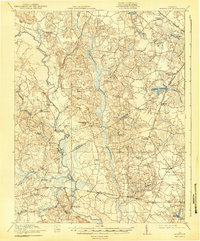
1920 Map of Homeville
USGS Topo · Published 1943About this map
Nottoway River meanders through the heart of Sussex and Southampton counties, serving as the primary geographical spine for a region defined by extensive wetlands and scattered agricultural settlements. During this post-World War I era, the landscape is heavily marked by its water-driven economy and transit networks, featuring numerous millponds like Harris Millpond and Airfield Millpond that supported local industry. The settlement of Sebrell serves as a key rail junction for the Virginian railroad, while smaller crossroads like Homeville and Lumberton anchor the surrounding rural tracts. The intricate network of swampy lowlands, including Assamoosick Swamp and Seacock Swamp, dictated the placement of historic crossings such as Peters Bridge and Carey Bridge. Numerous rural institutions, from Plank Road Church to the Cabin Point School, provide a detailed look at the social geography of the Virginia tidewater region before modern highway expansion altered these traditional community centers.
Find a feature on this map
52 named features on this map. Tap any name to fly to it.
Don’t see what you’re looking for? This feature index may not catch every label — zoom into the map to look around manually.
Map Details
Editions of this 1920 Homeville Map
3 editions found
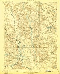
Other maps of this area

1894 · Petersburg
USGS Topo · 1:62,500

1919 · Jarratt
USGS Topo · 1:62,500

1919 · Surry
USGS Topo · 1:62,500

1919 · Disputanta
USGS Topo · 1:62,500

1919 · Homeville
USGS Topo · 1:48,000

1919 · Boykins
USGS Topo · 1:48,000

1919 · Arringdale
USGS Topo · 1:48,000

1920 · Holland
USGS Topo · 1:62,500

1920 · Ivor
USGS Topo · 1:62,500

1920 · Homeville
USGS Topo · 1:62,500