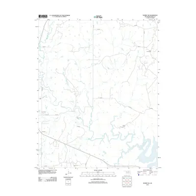
2012 Map of Hominy NE
USGS Topo · Published 2012About this map
The northern waters of Skiatook Lake define the southern landscape of this Osage County region, where Oklahoma's energy history is clearly mapped through several active extraction zones. Multiple named oil operations, including the Canyon Creek Oil Field and Flesher Oil Field, punctuate the rural terrain. The hydrology of the area is a complex network of tributaries such as Hominy Cr, Mahala Cr, and Sand Cr, which feed into the larger reservoir system.
Find a feature on this map
31 named features on this map. Tap any name to fly to it.
Don’t see what you’re looking for? This feature index may not catch every label — zoom into the map to look around manually.
Map Details
Editions of this 2012 Hominy NE Map
This is the sole edition of this map. No revisions or reprints were ever made.
Other maps of this area

1909 · Pawhuska
USGS Topo · 1:125,000

1910 · Pawhuska
USGS Topo · 1:125,000

1912 · Hominy
USGS Topo · 1:125,000

1915 · Hominy
USGS Topo · 1:125,000

1915 · Hominy
USGS Topo · 1:62,500

1955 · Enid
USGS Topo · 1:250,000

1958 · Enid
USGS Topo · 1:250,000

1964 · Barnsdall
USGS Topo · 1:24,000
1964 · Wynona
USGS Topo · 1:24,000

1966 · Cleveland
USGS Topo · 1:24,000