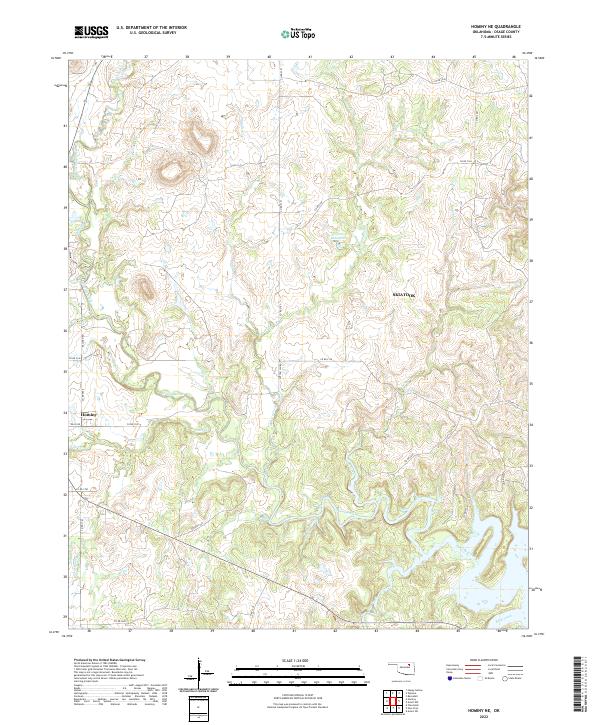
2022 Map of Hominy NE
USGS Topo · Published 2022About this map
Hominy occupies the western edge of this landscape in Osage County, where the plains of northern Oklahoma transition into the expansive drainage basins of the Skiatook area. The terrain is defined by a dense network of watercourses, most notably the meandering Hominy Creek and its many tributaries including Sand Creek, Mahala Creek, and Penn Cr. This intricate hydrography suggests a region deeply shaped by its watershed, particularly with the presence of the 113062 Reservoir near Sunset Cr.
Find a feature on this map
38 named features on this map. Tap any name to fly to it.
Don’t see what you’re looking for? This feature index may not catch every label — zoom into the map to look around manually.
Map Details
Editions of this 2022 Hominy NE Map
This is the sole edition of this map. No revisions or reprints were ever made.
Other maps of this area

1909 · Pawhuska
USGS Topo · 1:125,000

1910 · Pawhuska
USGS Topo · 1:125,000

1912 · Hominy
USGS Topo · 1:125,000

1915 · Hominy
USGS Topo · 1:125,000

1915 · Hominy
USGS Topo · 1:62,500

1955 · Enid
USGS Topo · 1:250,000

1958 · Enid
USGS Topo · 1:250,000

1964 · Barnsdall
USGS Topo · 1:24,000
1964 · Wynona
USGS Topo · 1:24,000

1966 · Cleveland
USGS Topo · 1:24,000