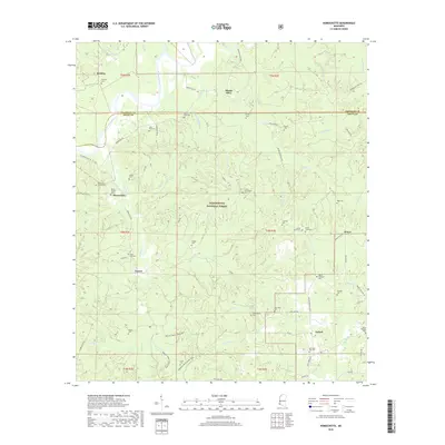
2018 Map of Homochitto
USGS Topo · Published 2018About this map
The Homochitto National Forest encompasses much of this landscape along the border of Franklin Co and Amite Co. Centered on the winding path of the Homochitto River, this 2018 survey documents a deeply rural region characterized by small settlements like Bunkley, Eunice, and Oxford. The map is particularly rich in genealogical data, preserving the locations of numerous family and community burial grounds including the Marvin Huff Cem, Old Mount Vernon Cem, and Jonathan Day Cem.
Find a feature on this map
81 named features on this map. Tap any name to fly to it.
Don’t see what you’re looking for? This feature index may not catch every label — zoom into the map to look around manually.
Map Details
Editions of this 2018 Homochitto Map
This is the sole edition of this map. No revisions or reprints were ever made.
Other maps of this area

1953 · Natchez
USGS Topo · 1:250,000

1956 · Natchez
USGS Topo · 1:250,000

1959 · Natchez
USGS Topo · 1:250,000

1961 · Liberty
USGS Topo · 1:62,500

1961 · Crosby
USGS Topo · 1:62,500

1961 · Gloster
USGS Topo · 1:62,500

1962 · Bude
USGS Topo · 1:62,500

1984 · McComb
USGS Topo · 1:100,000

1984 · Woodville
USGS Topo · 1:100,000
1988 · Homochitto
USGS Topo · 1:24,000