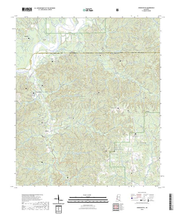
2024 Map of Homochitto
USGS Topo · Published 2024About this map
The Homochitto River flows through the heart of this southwestern Mississippi landscape, defining the boundary between Franklin and Amite counties. This territory is characterized by the expansive Homochitto National Forest, where the terrain is intricately carved by numerous drainages like Caston Creek and Buckles Creek. The map documents a scattered rural settlement pattern, anchored by small communities such as Homochitto and Bunkley. Genealogists will find a wealth of family-named landmarks and resting places, including the Old Mount Vernon Cem, John Huff Cem, and Jonathan Day Cem. Significant local institutions are recorded here, notably the Mount Vernon Methodist Church Cem and the New Hope Methodist Protestant Church Cem. Historical river crossings like Buckleys Ferry suggest the area's older transportation network before modern roads like Oxford-Meadville Rd predominated.
Find a feature on this map
85 named features on this map. Tap any name to fly to it.
Don’t see what you’re looking for? This feature index may not catch every label — zoom into the map to look around manually.
Map Details
Editions of this 2024 Homochitto Map
This is the sole edition of this map. No revisions or reprints were ever made.
Other maps of this area

1953 · Natchez
USGS Topo · 1:250,000

1956 · Natchez
USGS Topo · 1:250,000

1959 · Natchez
USGS Topo · 1:250,000

1961 · Liberty
USGS Topo · 1:62,500

1961 · Crosby
USGS Topo · 1:62,500

1961 · Gloster
USGS Topo · 1:62,500

1962 · Bude
USGS Topo · 1:62,500

1984 · McComb
USGS Topo · 1:100,000

1984 · Woodville
USGS Topo · 1:100,000
1988 · Homochitto
USGS Topo · 1:24,000