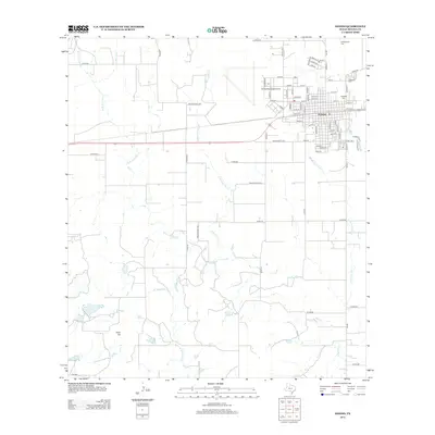
2012 Map of Hondo
USGS Topo · Published 2012About this map
Hondo serves as the focal point of this Medina County landscape, characterized by a transition from organized town streets to a network of rural county roads and private lanes. The town's layout is defined by numbered streets and alphabetical avenues, such as Avenue Y and Avenue Z, while the surrounding countryside is drained by an intricate system of creeks. The eastern edge of town is marked by Elm Slough and multiple burial grounds including Oakwood Cem and Ingleside Cem. To the north, the Hondo Municipal Airport occupies a significant footprint near Cottonwood Cem. The southern terrain rises toward Fohn Hill and is crossed by several watercourses including W Tehuacana Cr and Blue Oak Cr, illustrating the hydrological pattern of the Texas Hill Country fringe where seasonal creeks dictate the placement of ranch roads and property boundaries.
Find a feature on this map
81 named features on this map. Tap any name to fly to it.
Don’t see what you’re looking for? This feature index may not catch every label — zoom into the map to look around manually.
Map Details
Editions of this 2012 Hondo Map
This is the sole edition of this map. No revisions or reprints were ever made.
Other maps of this area

1928 · Frio Town
USGS Topo · 1:62,500

1954 · San Antonio
USGS Topo · 1:250,000

1956 · Sabinal
USGS Topo · 1:62,500

1956 · New Fountain
USGS Topo · 1:62,500

1957 · San Antonio
USGS Topo · 1:250,000
1964 · Biry
USGS Topo · 1:24,000

1964 · Yancey
USGS Topo · 1:24,000

1969 · Sabinal NE
USGS Topo · 1:24,000
1969 · Quihi
USGS Topo · 1:24,000
1969 · Mustang Valley
USGS Topo · 1:24,000