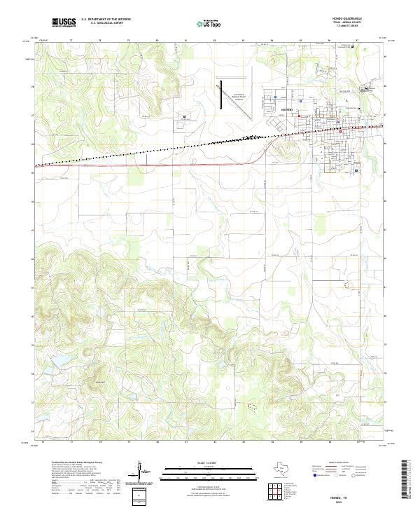
2022 Map of Hondo
USGS Topo · Published 2022About this map
The Medina County Courthouse stands as the central landmark of Hondo, anchoring a grid of streets that transition quickly into the ranchlands and creek drainages of the Texas Hill Country foothills. This modern survey illustrates the proximity of the city to the South Texas Regional Airport at Hondo, while also documenting the outlying community of New Fountain to the northeast. The geography is defined by an intricate network of seasonal waterways, including W Tehuacana Cr and branches of Live Oak Cr, which cut through the terrain toward the south. Genealogists will find several burial sites recorded, such as Ingleside Cem, Oakwood Cem, and the more distant Cottonwood Community Cem. To the west, the elevation rises at Fohn Hill, overlooking a landscape of private roads and farm-to-market routes that support the area's agricultural character.
Find a feature on this map
93 named features on this map. Tap any name to fly to it.
Don’t see what you’re looking for? This feature index may not catch every label — zoom into the map to look around manually.
Map Details
Editions of this 2022 Hondo Map
This is the sole edition of this map. No revisions or reprints were ever made.
Other maps of this area

1928 · Frio Town
USGS Topo · 1:62,500

1954 · San Antonio
USGS Topo · 1:250,000

1956 · Sabinal
USGS Topo · 1:62,500

1956 · New Fountain
USGS Topo · 1:62,500

1957 · San Antonio
USGS Topo · 1:250,000
1964 · Biry
USGS Topo · 1:24,000

1964 · Yancey
USGS Topo · 1:24,000

1969 · Sabinal NE
USGS Topo · 1:24,000
1969 · Quihi
USGS Topo · 1:24,000
1969 · Mustang Valley
USGS Topo · 1:24,000