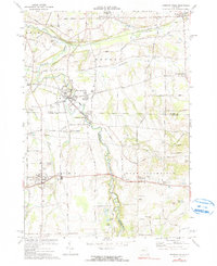
1971 Map of Honeoye Falls
USGS Topo · Published 1990About this map
Honeoye Creek meanders through the heart of this landscape, connecting the industrial and residential centers of Honeoye Falls and North Bloomfield. The 1971 survey captures a transition in transportation, showing the Lehigh Valley Railroad and its connection at Rochester Junction alongside an Old Railroad Grade that speaks to earlier rail eras. The region is dotted with historic crossroads and rural hamlets such as Mendon Center, Sibleyville, and West Bloomfield. Genealogical interest is found in the local burial grounds, including St Pauls Cem and Pioneer Cem, as well as named family corners like Commins Corners and Tomlinson Corners. The map also details the natural drainage of the area, featuring Irondequoit Creek, Trout Creek, and several wetlands including Mud Pond and Round Pond near the southern boundary.
Find a feature on this map
67 named features on this map. Tap any name to fly to it.
Don’t see what you’re looking for? This feature index may not catch every label — zoom into the map to look around manually.
Map Details
Editions of this 1971 Honeoye Falls Map
Other maps of this area

1895 · Rochester
USGS Topo · 1:62,500

1898 · Rochester
USGS Topo · 1:62,500

1900 · Macedon
USGS Topo · 1:62,500

1900 · Canandaigua
USGS Topo · 1:62,500

1901 · Honeoye
USGS Topo · 1:62,500

1903 · Canandaigua
USGS Topo · 1:62,500

1904 · Honeoye
USGS Topo · 1:62,500

1912 · Rochester
USGS Topo · 1:62,500

1920 · Rochester
USGS Topo · 1:62,500

1931 · Mendon Ponds
USGS Topo · 1:24,000