
1942 Map of Honey Hill
USGS Topo · Published 1962About this map
Francis Marion National Forest dominates this South Carolina landscape, where the Santee River forms the northern boundary against Wadmacon Island. The terrain is defined by its drainage into the Wambaw Swamp, with numerous named waterways like Wambaw Creek and Coffee Creek Swamp carving through the timberland. Mapping conducted by the Army Map Service in 1942 highlights a network of small, rural settlements and isolated landings that served the local river economy.
Find a feature on this map
30 named features on this map. Tap any name to fly to it.
Don’t see what you’re looking for? This feature index may not catch every label — zoom into the map to look around manually.
Map Details
Editions of this 1942 Honey Hill Map
3 editions found
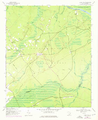
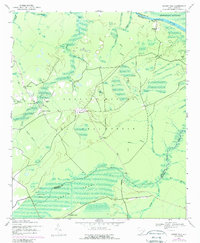
Other maps of this area

1942 · Cedar Creek
USGS Topo · 1:24,000

1942 · Mc Clellanville
USGS Topo · 1:24,000

1943 · Shulerville
USGS Topo · 1:24,000

1943 · Kilsock Bay
USGS Topo · 1:24,000

1943 · Jamestown
USGS Topo · 1:24,000

1943 · Santee
USGS Topo · 1:24,000

1943 · Awendaw
USGS Topo · 1:24,000

1943 · Ocean Bay
USGS Topo · 1:24,000

1949 · Georgetown
USGS Topo · 1:250,000

1967 · Georgetown
USGS Topo · 1:250,000