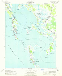
1942 Map of Honga
USGS Topo · Published 1969About this map
Hooper Island anchors this mid-century maritime study of the Honga River shoreline, depicting a landscape defined by the water-dependent economies of Dorchester County. The map reveals the intricate geography of the Eastern Shore, where long peninsulas like Meekins Neck and Kerwin Neck are separated by tidal guts and expansive marshes like Hell Hook Marsh. A glimpse into the local industry is visible at Crapo, where a Cannery sits near the head of Fox Creek.
Find a feature on this map
74 named features on this map. Tap any name to fly to it.
Don’t see what you’re looking for? This feature index may not catch every label — zoom into the map to look around manually.
Map Details
Editions of this 1942 Honga Map
3 editions found
Other maps of this area

1892 · Drum Point
USGS Topo · 1:62,500

1894 · Point Lookout
USGS Topo · 1:62,500

1898 · St. Marys
USGS Topo · 1:125,000

1901 · Drum Point
USGS Topo · 1:62,500

1903 · Bloodsworth Island
USGS Topo · 1:62,500

1905 · Crapo
USGS Topo · 1:62,500

1905 · Drum Point
USGS Topo · 1:62,500

1906 · St. Marys
USGS Topo · 1:125,000

1912 · Point Lookout
USGS Topo · 1:62,500

1937 · Point Lookout
USGS Topo · 1:62,500