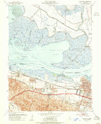
1953 Map of Honker Bay
USGS Topo · Published 1955About this map
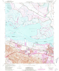
Industrial expansion and military presence define this mid-century portrait of the Suisun Bay shoreline. The city of Pittsburg serves as an urban anchor, surrounded by specialized infrastructure including a Chemical Plant, an Oil Refinery, and a Filtration Plant. This industrial core is hemmed in by significant military and maritime activity, with the sprawling Camp Stoneman to the southeast and a large Naval Reservation to the west.
Find a feature on this map
77 named features on this map. Tap any name to fly to it.
Don’t see what you’re looking for? This feature index may not catch every label — zoom into the map to look around manually.
Map Details
Editions of this 1953 Honker Bay Map
7 editions found
Other maps of this area

1896 · Carquinez Strait
USGS Topo · 1:62,500

1896 · Mt. Diablo
USGS Topo · 1:62,500

1897 · Concord
USGS Topo · 1:62,500

1898 · Karquines
USGS Topo · 1:62,500

1898 · Mt. Diablo
USGS Topo · 1:62,500

1901 · Karquines
USGS Topo · 1:62,500

1902 · Napa
USGS Topo · 1:125,000

1907 · Antioch
USGS Topo · 1:62,500

1908 · Antioch
USGS Topo · 1:62,500

1915 · Concord
USGS Topo · 1:62,500