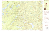
1989 Map of Honnedaga Lake
USGS Topo · Published 1989About this map
Honnedaga Lake and its surrounding wilderness define this portion of the Adirondack Park in the late 1980s. The landscape is dominated by a complex network of glacial lakes and river headwaters, including the North Lake, South Lake, and the sprawling Woodhull Lake. Small outposts and camps like Atwell and Bisby Lodge represent the limited human footprint in this densely forested region of Ohio and Webb townships.
Find a feature on this map
73 named features on this map. Tap any name to fly to it.
Don’t see what you’re looking for? This feature index may not catch every label — zoom into the map to look around manually.
Map Details
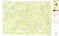
Editions of this 1989 Honnedaga Lake Map
2 editions found
Other maps of this area

1897 · Remsen
USGS Topo · 1:62,500

1900 · Remsen
USGS Topo · 1:62,500

1900 · Canada Lake
USGS Topo · 1:62,500

1900 · Wilmurt
USGS Topo · 1:62,500

1901 · Old Forge
USGS Topo · 1:62,500

1902 · Wilmurt
USGS Topo · 1:62,500

1903 · West Canada Lakes
USGS Topo · 1:62,500

1904 · Piseco Lake
USGS Topo · 1:62,500

1906 · Piseco Lake
USGS Topo · 1:62,500

1908 · Piseco Lake
USGS Topo · 1:62,500