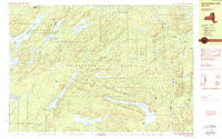
1989 Map of Honnedaga Lake
USGS Topo · Published 1989About this map
Adirondack Park dominates this 1980s landscape, where the headwaters of the Black River and its various branches carve through the Raymond Hills and Canachagala Mountain. The area is characterized by a high concentration of remote water bodies, including the expansive Honnedaga Lake and Woodhull Lake. Small outposts like Bisby Lodge, Forest Lodge, and the settlement at Atwell provide the only significant human footprints amidst a dense network of peaks such as Ice Cave Mountain and Stair Mountain.
Find a feature on this map
73 named features on this map. Tap any name to fly to it.
Don’t see what you’re looking for? This feature index may not catch every label — zoom into the map to look around manually.
Map Details
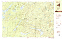
Editions of this 1989 Honnedaga Lake Map
2 editions found
Other maps of this area

1897 · Remsen
USGS Topo · 1:62,500

1900 · Remsen
USGS Topo · 1:62,500

1900 · Canada Lake
USGS Topo · 1:62,500

1900 · Wilmurt
USGS Topo · 1:62,500

1901 · Old Forge
USGS Topo · 1:62,500

1902 · Wilmurt
USGS Topo · 1:62,500

1903 · West Canada Lakes
USGS Topo · 1:62,500

1904 · Piseco Lake
USGS Topo · 1:62,500

1906 · Piseco Lake
USGS Topo · 1:62,500

1908 · Piseco Lake
USGS Topo · 1:62,500