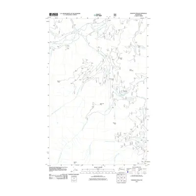
2011 Map of Hoodoo Peak
USGS Topo · Published 2011About this map
Hoodoo Peak and Mission Peak anchor the southern reaches of this mountainous Okanogan County landscape, where the headwaters of several critical drainages originate. The Twisp River cuts through the northern section, fed by a network of tributaries including Buttermilk Creek and Canyon Creek. This terrain is defined by its high ridges and secluded basins, such as Newby Ridge and the Shady Nook Basin, which historically dictated the paths of forest development roads like the E Buttermilk Creek Rd. Recreational and water resources are clustered around Black Pine Lake, where the Blackpine Lake Campground sits near the base of Block Mountain. This survey provides a precise look at the hydrology of the eastern Cascades, tracing the intricate forks of Libby Creek and Buttermilk Creek as they navigate around obstacles like Buttermilk Butte and Scaffold Ridge.
Find a feature on this map
28 named features on this map. Tap any name to fly to it.
Don’t see what you’re looking for? This feature index may not catch every label — zoom into the map to look around manually.
Map Details
Editions of this 2011 Hoodoo Peak Map
This is the sole edition of this map. No revisions or reprints were ever made.
Other maps of this area

1899 · Methow
USGS Topo · 1:125,000

1901 · Methow
USGS Topo · 1:125,000

1955 · Concrete
USGS Topo · 1:250,000

1958 · Concrete
USGS Topo · 1:250,000

1962 · Concrete
USGS Topo · 1:250,000
1968 · Hungry Mtn
USGS Topo · 1:24,000
1969 · Midnight Mtn.
USGS Topo · 1:24,000
1969 · Martin Peak
USGS Topo · 1:24,000
1969 · Prince Creek
USGS Topo · 1:24,000
1969 · Thompson Ridge
USGS Topo · 1:24,000