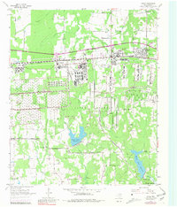
1954 Map of Hooks
USGS Topo · Published 1981About this map
The Red River Arsenal dominates the mid-century landscape of Bowie County, showing a massive complex of military infrastructure and boundaries south of Hooks. This 1954 survey, updated with 1970 revisions, illustrates a transition from rural homesteads to a significant defense installation. The influence of the Texas and Pacific and St Louis Southwestern railroads highlights the area's importance as a logistics hub, while several country schools and churches like the Arkadelphia Sch and Myrtle Springs Ch remain as markers of the earlier community fabric.
Find a feature on this map
32 named features on this map. Tap any name to fly to it.
Don’t see what you’re looking for? This feature index may not catch every label — zoom into the map to look around manually.
Map Details
Editions of this 1954 Hooks Map

Other maps of this area

1909 · New Boston
USGS Topo · 1:62,500

1909 · Texarkana
USGS Topo · 1:62,500

1950 · Redbank
USGS Topo · 1:24,000

1950 · Barkman
USGS Topo · 1:24,000

1951 · Redbank
USGS Topo · 1:24,000

1951 · Barkman
USGS Topo · 1:24,000

1951 · Daniels Chapel
USGS Topo · 1:24,000

1953 · Texarkana
USGS Topo · 1:250,000

1954 · New Boston
USGS Topo · 1:24,000

1954 · Leary
USGS Topo · 1:24,000