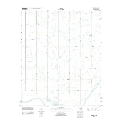
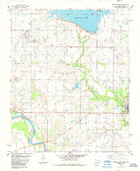
2012 Map of Hooper
USGS Topo · Published 2012About this map
The Red River forms the southern boundary of this landscape along the Oklahoma-Texas border, where the meandering course of Whiskey Cr drains the agricultural plains of Cotton County. The small settlement of Hooper serves as a central point in a strictly organized grid of rural section roads, illustrating the enduring legacy of the Public Land Survey System in the Great Plains. In the northeastern corner, Hastings Cem provides a focal point for genealogical research, situated near the intersection of e1910 RD and n2720 RD. The map reveals a transition from the structured upland farms to the more fluid, irregular topography of the river bottomlands, where the natural watercourses contrast with the rigid human engineering of the surrounding road network.
Find a feature on this map
20 named features on this map. Tap any name to fly to it.
Don’t see what you’re looking for? This feature index may not catch every label — zoom into the map to look around manually.
Map Details
Editions of this 2012 Hooper Map
This is the sole edition of this map. No revisions or reprints were ever made.
Other maps of this area

1955 · Lawton
USGS Topo · 1:250,000

1957 · Hastings
USGS Topo · 1:62,500

1957 · Randlett
USGS Topo · 1:62,500

1962 · Walters
USGS Topo · 1:62,500

1962 · Temple
USGS Topo · 1:62,500
1972 · Charlie
USGS Topo · 1:24,000

1984 · Hooper
USGS Topo · 1:24,000
1984 · Irving
USGS Topo · 1:24,000
1984 · Petrolia
USGS Topo · 1:24,000
1984 · Waurika West
USGS Topo · 1:24,000