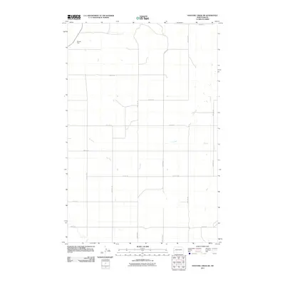
2011 Map of Hootowl Creek SW
USGS Topo · Published 2011About this map
Metcalf Dam stands as a primary water management landmark in this rural landscape of Golden Valley County, where the topography is defined by the drainage basins of Elk Creek and Dry Creek. The area is organized by a precise grid of sectional roads, reflecting the systematic agricultural development characteristic of North Dakota. Prominent thoroughfares such as County Rd 5 and Mosher Rd facilitate transit across the open terrain, connecting scattered farmsteads and agricultural plots. The map captures the quiet character of the region in the early 21st century, showing how drainage features like the winding Elk Creek dictate the placement of local infrastructure like 163rd Ave SW. This survey provides a clear view of the intersection between modern land use and the natural prairie hydrology.
Find a feature on this map
16 named features on this map. Tap any name to fly to it.
Don’t see what you’re looking for? This feature index may not catch every label — zoom into the map to look around manually.
Map Details
Editions of this 2011 Hootowl Creek SW Map
This is the sole edition of this map. No revisions or reprints were ever made.
Other maps of this area

1909 · Glendive
USGS Topo · 1:250,000

1953 · Miles City
USGS Topo · 1:250,000

1953 · Dickinson
USGS Topo · 1:250,000

1953 · Watford City
USGS Topo · 1:250,000

1954 · Glendive
USGS Topo · 1:250,000

1957 · Dickinson
USGS Topo · 1:250,000

1957 · Miles City
USGS Topo · 1:250,000

1957 · Glendive
USGS Topo · 1:250,000

1957 · Watford City
USGS Topo · 1:250,000

1958 · Miles City
USGS Topo · 1:250,000
Featured Places
- Elmwood Township, ND
- Saddle Butte Township, ND
- Delhi Township, ND
- Elk Creek Township, ND
- Golden Valley County, ND