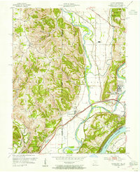
1954 Map of Hooven
USGS Topo · Published 1955About this map
The Whitewater River and Miami River converge in this mid-century survey of the tri-state border region, where Ohio, Indiana, and Kentucky meet. The landscape is defined by its transit corridors, specifically the New York Central Railroad and the Baltimore and Ohio Railroad, which intersect at rail hubs like Valley Junction and Lawrenceburg Junction. Near the town of Hooven, industrial development is evidenced by a prominent Gas Refinery and Radio Tower, contrasting with the preserved lands of Whitewater Forest and Harrison State Park. Genealogists will find several burial sites recorded, including Harrison Cem, Sugar Ridge Cem, and Maple Grove Cem. The topography transitions from the high ground of Harrison Hill and Georgetown Ridge down to the fertile North Bend Bottom along the Ohio River.
Find a feature on this map
60 named features on this map. Tap any name to fly to it.
Don’t see what you’re looking for? This feature index may not catch every label — zoom into the map to look around manually.
Map Details
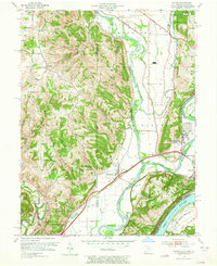
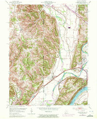
Editions of this 1954 Hooven Map
Other maps of this area

1914 · West Cincinnati
USGS Topo · 1:62,500

1915 · Lawrenceburg
USGS Topo · 1:48,000

1915 · Harrison
USGS Topo · 1:48,000

1915 · Hamilton
USGS Topo · 1:62,500

1917 · Hamilton
USGS Topo · 1:62,500

1928 · Lawrenceburg
USGS Topo · 1:62,500

1932 · Lawrenceburg
USGS Topo · 1:62,500

1943 · Aurora
USGS Topo · 1:24,000

1943 · Hooven
USGS Topo · 1:24,000

1943 · Guilford
USGS Topo · 1:24,000