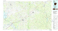
1986 Map of Hope
USGS Topo · Published 1986About this map
The southwest Arkansas corridor between Hope and Prescott is defined by the heavy infrastructure of the Missouri Pacific Railroad, which cuts a straight line through the center of this 1986 survey. This regional network of small agricultural hubs like Blevins, Emmet, and McCaskill is oriented around the fertile creek basins that feed into the Red River and Little River. Significant land use is evident at the University of Arkansas Experiment Station near Hope, while the eastern edge of the map features the dense woodlands of Poison Springs State Forest and the recreation areas at White Oak Lake State Park. Genealogists will find the locations of local landmarks such as De Ann Cem, Camp Spring Church, and Crossroads Church preserved at a time when the region's rural character remained firmly established amidst its transition into a modern transportation and agricultural hub.
Find a feature on this map
155 named features on this map. Tap any name to fly to it.
Don’t see what you’re looking for? This feature index may not catch every label — zoom into the map to look around manually.
Map Details
Editions of this 1986 Hope Map
2 editions found
Other maps of this area

1901 · Gurdon
USGS Topo · 1:125,000

1903 · Camden
USGS Topo · 1:125,000

1906 · Caddo Gap
USGS Topo · 1:125,000

1909 · Texarkana
USGS Topo · 1:62,500

1913 · De Queen
USGS Topo · 1:125,000

1943 · Antoine
USGS Topo · 1:62,500

1950 · Mcalester
USGS Topo · 1:250,000

1950 · Ashdown East
USGS Topo · 1:24,000

1950 · Ogden
USGS Topo · 1:24,000

1950 · Red Bluff
USGS Topo · 1:24,000