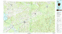
1986 Map of Hope
USGS Topo · Published 1988About this map
Hope serves as a central hub for southwestern Arkansas in the mid-1980s, where the Missouri Pacific RR corridor dictates the orientation of many regional settlements like Emmet and Prescott. The landscape is defined by the convergence of the Little River and the Red River in the southwest, while the expansive Millwood Lake borders the western edge of the quadrangle. Significant institutional presence is found at the University of Arkansas Experiment Station and the Howard County Memorial Hospital, reflecting the area's development as an agricultural and service center.
Find a feature on this map
227 named features on this map. Tap any name to fly to it.
Don’t see what you’re looking for? This feature index may not catch every label — zoom into the map to look around manually.
Map Details
Editions of this 1986 Hope Map
2 editions found
Other maps of this area

1901 · Gurdon
USGS Topo · 1:125,000

1903 · Camden
USGS Topo · 1:125,000

1906 · Caddo Gap
USGS Topo · 1:125,000

1909 · Texarkana
USGS Topo · 1:62,500

1913 · De Queen
USGS Topo · 1:125,000

1943 · Antoine
USGS Topo · 1:62,500

1950 · Mcalester
USGS Topo · 1:250,000

1950 · Ashdown East
USGS Topo · 1:24,000

1950 · Ogden
USGS Topo · 1:24,000

1950 · Red Bluff
USGS Topo · 1:24,000