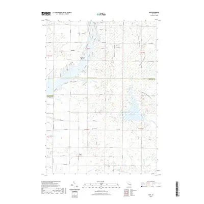
2019 Map of Hope
USGS Topo · Published 2019About this map
Billings and Hope serve as the primary hubs in this lake-and-drainage landscape along the Gladwin and Midland county border. The area is defined by its complex hydrology, with the Tittabawassee River system forming Wixom Lake and numerous drainage networks like Davids Drain and Schoolhouse Drain managing the low-lying terrain. To the east, the Kawkawlin Creek Flooding and Kawkawlin Creek indicate the heavy management of water levels common to this part of Michigan. A distinct geological feature, the Sand Ridge, runs through the northeast, providing a rare stretch of elevated ground. For researchers, the presence of three distinct burial grounds—Billings Cem, Hope Cem, and New Hope Cem—offers specific points of interest for genealogical study. The Midland to Mackinaw Boy Scout Trail also transits the eastern portion of the sheet, following the traditional routes northward through the wooded wetlands.
Find a feature on this map
63 named features on this map. Tap any name to fly to it.
Don’t see what you’re looking for? This feature index may not catch every label — zoom into the map to look around manually.
Map Details
Editions of this 2019 Hope Map
This is the sole edition of this map. No revisions or reprints were ever made.
Other maps of this area

1934 · Sanford
USGS Topo · 1:62,500

1936 · Sanford
USGS Topo · 1:62,500

1954 · Midland
USGS Topo · 1:250,000

1958 · Midland
USGS Topo · 1:250,000

1959 · Midland
USGS Topo · 1:250,000

1962 · Midland North
USGS Topo · 1:24,000

1966 · Midland
USGS Topo · 1:250,000

1969 · Gladwin
USGS Topo · 1:24,000
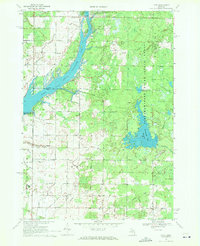
1969 · Hope
USGS Topo · 1:24,000
1969 · Bentley
USGS Topo · 1:24,000